
1989 · Accessory (dice, maps, screens, cards)
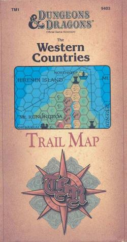
The Western Countries Trail Map
A detailed fantasy map of the western region of the Known World, covering the lands from Glantri to Rockhome and from the Ethengar plains to the Isles of Ierendi. It presents nations, trails, weather, terrain conditions, astronomy, and other regional information in an 8-mile-per-hex Gazetteer-style format. The full-color map measures 36 by 57 inches.
- Players
- 0
- Complexity
- 1 / 5
Attribute/Stat Based (STR, CON, PER, etc)Random Attribute Generation (during Character Creation)Race Based (Player Race/Species affects gameplay)
About the game
- Design
- Art

Expansion for
See them in Ludoya
Free, on web, Android and iOS
Play The Western Countries Trail Map with Ludoya
- Keep it in your collectionTrack your copy and its expansions, lend it to friends, or put it on your wishlist and get told when the price drops.Add it to your collection
- Log every playScores, winners, timers and photos, then your stats: win rate, favourite player count, best score.Log a play
- Score it without paperUse the community's score sheets and play helpers, and let Ludoya add up the points.Find score sheets
- Find people to play it withClubs, game nights and events near you that bring this game to the table.See events
Game facts (players, playing time, age, credits) from BoardGameGeek.