
2000 · Аксесоар (зарове, карти, екрани, карти за игра)
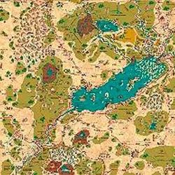
Country of Arduin Map
A full 2 x 3 ft, four-color poster map of Arduin, reproduced from David Hargrave’s original hand-drawn maps on parchment-style paper. It shows roads, cities, towns, villages, forests, named mountains, swamps, islands, seas, lakes, and other major geography, with a legend and scale included. The map is rolled and shipped in a tube.
Базиран на атрибути/статистики (STR, CON, PER и др.)Базиран на нива (печелете XP и повишавайте ниво)Базиран на класове (Пилот, Маг, Учен и т.н.)
За играта
- Дизайн
- Илюстрации
- Издател

Разширение за
Виж ги в Ludoya


Безплатно, в уеб, Android и iOS
Играй Country of Arduin Map с Ludoya
- Пази я в колекцията сиСледи своето копие и разширенията му, заеми го на приятели или го добави в списъка с желания и получи известие, когато цената падне.Добави я в колекцията си
- Записвай всяка партияТочки, победители, таймери и снимки, а после статистиката ти: процент на победи, любим брой играчи, най-добър резултат.Запиши партия
- Точки без хартияИзползвай листовете за резултати и помощниците за игра на общността и остави Ludoya да събере точките.Намери листове за резултати
- Намери с кого да я играешКлубове, игрални вечери и събития близо до теб, където тази игра е на масата.Виж събитията
Данни за играта (играчи, времетраене, възраст, автори) от BoardGameGeek.