
2005 · ملحق (نرد، خرائط، شاشات، بطاقات)
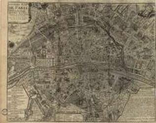
Paris of the 1700's
A historical map depicting Paris as understood in the 1700s, including named streets, districts, parks, local sites, and the Seine. A key identifies the city’s quarters and their estimated founding dates. It can be used as a reference for historical role-playing or displayed as a period map. Print size: 40.5 × 31.9 inches.
- اللاعبون
- 0
عن اللعبة
- التصميم
- الرسوم
- دار نشر

توسعة لـ
شاهدها في Ludoya
مجاني، على الويب وAndroid وiOS
العب Paris of the 1700's مع Ludoya
- احتفظ بها في مجموعتكتابع نسختك وتوسعاتها، وأعرها لأصدقائك، أو أضفها إلى قائمة رغباتك ليصلك تنبيه عندما ينخفض السعر.أضفها إلى مجموعتك
- سجّل كل جلسة لعبالنقاط والفائزون والمؤقتات والصور، ثم إحصاءاتك: نسبة الفوز، وعدد اللاعبين المفضل، وأفضل نتيجة.سجّل جلسة لعب
- احسب النقاط بلا ورقاستخدم أوراق النقاط وأدوات اللعب من المجتمع، ودع Ludoya يجمع النقاط.ابحث عن أوراق النقاط
- اعثر على من تلعبها معهمأندية وأمسيات ألعاب وفعاليات قريبة منك تلعب هذه اللعبة.عرض الفعاليات
معلومات اللعبة (اللاعبون، مدة اللعب، العمر، فريق العمل) مأخوذة من BoardGameGeek.