
2005 · Lisävaruste (nopat, kartat, näkösuojat, kortit)
Paris of the 1700's
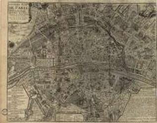
A historical map depicting Paris as understood in the 1700s, including named streets, districts, parks, local sites, and the Seine. A key identifies the city’s quarters and their estimated founding dates. It can be used as a reference for historical role-playing or displayed as a period map. Print size: 40.5 × 31.9 inches.
- Pelaajat
- 0
Tietoa pelistä
- Suunnittelu
- Kuvitus
- Julkaisija

Laajennus peliin
Katso ne Ludoyassa
Ilmainen, verkossa, Androidilla ja iOS:llä
Pelaa peliä Paris of the 1700's Ludoyalla
- Pidä se kokoelmassasiPidä kirjaa kappaleestasi ja sen laajennuksista, lainaa sitä ystäville tai lisää se toivelistallesi ja saat tiedon, kun hinta laskee.Lisää se kokoelmaasi
- Kirjaa jokainen pelisessioPisteet, voittajat, ajastimet ja kuvat, sitten tilastosi: voittoprosentti, suosikkipelaajamäärä, paras tulos.Kirjaa pelisessio
- Pisteet ilman paperiaKäytä yhteisön pistelomakkeita ja peliapureita ja anna Ludoyan laskea pisteet.Etsi pistelomakkeita
- Löydä pelikavereitaKerhot, peli-illat ja tapahtumat lähelläsi, joissa tätä peliä pelataan.Katso tapahtumat
Pelin tiedot (pelaajat, peliaika, ikä, tekijät) lähteestä BoardGameGeek.