
2004 · Аксесоар (зарове, карти, екрани, карти за игра)
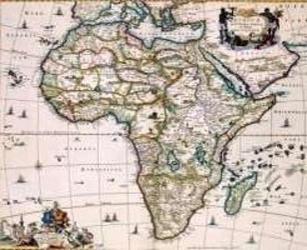
Africa of the 1600's
A decorative historical map depicting Africa as charted by Niccolaas Visscher II around 1681. The coastlines are shown in greater detail, while much of the interior remains unexplored and marked with period-era geography, making it suitable for 17th-century role-playing settings, lost empires, and exploration scenarios. The printed map measures approximately 55.5 by 45 inches and can also be used as wall décor.
- Играчи
- 0
За играта
- Дизайн
- Илюстрации
- Издател

Разширение за
Виж ги в Ludoya
Безплатно, в уеб, Android и iOS
Играй Africa of the 1600's с Ludoya
- Пази я в колекцията сиСледи своето копие и разширенията му, заеми го на приятели или го добави в списъка с желания и получи известие, когато цената падне.Добави я в колекцията си
- Записвай всяка партияТочки, победители, таймери и снимки, а после статистиката ти: процент на победи, любим брой играчи, най-добър резултат.Запиши партия
- Точки без хартияИзползвай листовете за резултати и помощниците за игра на общността и остави Ludoya да събере точките.Намери листове за резултати
- Намери с кого да я играешКлубове, игрални вечери и събития близо до теб, където тази игра е на масата.Виж събитията
Данни за играта (играчи, времетраене, възраст, автори) от BoardGameGeek.