
2005 · Аксесоар (зарове, карти, екрани, карти за игра)
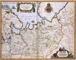
North Eastern Russia of the 1600's
A historical map of northeastern Russia as understood in the 1600s, depicting towns, cities, and borders recorded by Joan and Cornelis Blaeu. A detailed cartouche features the Russian coat of arms. The map measures 56 by 44.3 inches and is suited to historical gaming, role-playing, or display.
- Играчи
- 0
За играта
- Дизайн
- Илюстрации
- Издател

Разширение за
Виж ги в Ludoya
Безплатно, в уеб, Android и iOS
Играй North Eastern Russia of the 1600's с Ludoya
- Пази я в колекцията сиСледи своето копие и разширенията му, заеми го на приятели или го добави в списъка с желания и получи известие, когато цената падне.Добави я в колекцията си
- Записвай всяка партияТочки, победители, таймери и снимки, а после статистиката ти: процент на победи, любим брой играчи, най-добър резултат.Запиши партия
- Точки без хартияИзползвай листовете за резултати и помощниците за игра на общността и остави Ludoya да събере точките.Намери листове за резултати
- Намери с кого да я играешКлубове, игрални вечери и събития близо до теб, където тази игра е на масата.Виж събитията
Данни за играта (играчи, времетраене, възраст, автори) от BoardGameGeek.