
2005 · Tilbehør (terninger, kart, skjermer, kort)
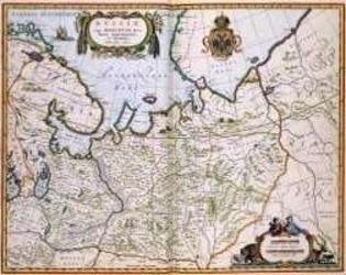
North Eastern Russia of the 1600's
A historical map of northeastern Russia as understood in the 1600s, depicting towns, cities, and borders recorded by Joan and Cornelis Blaeu. A detailed cartouche features the Russian coat of arms. The map measures 56 by 44.3 inches and is suited to historical gaming, role-playing, or display.
- Spillere
- 0
Om spillet
- Design
- Illustrasjon
- Utgiver

Utvidelse til
Se dem i Ludoya
Gratis, på nett, Android og iOS
Spill North Eastern Russia of the 1600's med Ludoya
- Ha det i samlingen dinHold oversikt over eksemplaret ditt og utvidelsene, lån det ut til venner, eller legg det på ønskelisten og få beskjed når prisen faller.Legg det til i samlingen din
- Registrer hver spilløktPoeng, vinnere, tidtakere og bilder, og så statistikken din: vinnerprosent, favorittantall spillere, beste poengsum.Registrer en spilløkt
- Før poeng uten papirBruk fellesskapets poengskjemaer og spillhjelpere, og la Ludoya legge sammen poengene.Finn poengskjemaer
- Finn folk å spille det medKlubber, spillkvelder og arrangementer nær deg der dette spillet kommer på bordet.Se arrangementer
Spillfakta (spillere, spilletid, alder, bidragsytere) fra BoardGameGeek.