
2000 · Akcesorium (kości, mapy, ekrany, karty)
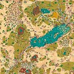
Country of Arduin Map
A full 2 x 3 ft, four-color poster map of Arduin, reproduced from David Hargrave’s original hand-drawn maps on parchment-style paper. It shows roads, cities, towns, villages, forests, named mountains, swamps, islands, seas, lakes, and other major geography, with a legend and scale included. The map is rolled and shipped in a tube.
Oparte na atrybutach/statystykach (STR, CON, PER itp.)Oparte na poziomach (zdobywaj PD i awansuj)Oparte na klasach (Pilot, Czarodziej, Naukowiec itp.)
O grze
- Projekt
- Grafika
- Wydawca

Dodatek do
Zobacz je w Ludoya


Za darmo, w przeglądarce, na Androidzie i iOS
Graj w Country of Arduin Map z Ludoya
- Miej ją w swojej kolekcjiŚledź swój egzemplarz i jego dodatki, pożyczaj go znajomym albo dodaj go do listy życzeń i dostań powiadomienie, gdy cena spadnie.Dodaj do swojej kolekcji
- Zapisuj każdą rozgrywkęPunkty, zwycięzcy, minutniki i zdjęcia, a potem twoje statystyki: procent zwycięstw, ulubiona liczba graczy, najlepszy wynik.Zapisz rozgrywkę
- Licz punkty bez papieruKorzystaj z arkuszy wyników i pomocy do gry od społeczności i pozwól Ludoya zsumować punkty.Znajdź arkusze wyników
- Znajdź ludzi do wspólnej gryKluby, wieczory gier i wydarzenia w pobliżu, na których ta gra trafia na stół.Zobacz wydarzenia
Dane gry (gracze, czas gry, wiek, twórcy) z BoardGameGeek.