
2005 · Аксессуар (кубики, карты, экраны, карточки)
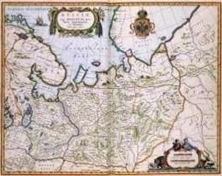
North Eastern Russia of the 1600's
A historical map of northeastern Russia as understood in the 1600s, depicting towns, cities, and borders recorded by Joan and Cornelis Blaeu. A detailed cartouche features the Russian coat of arms. The map measures 56 by 44.3 inches and is suited to historical gaming, role-playing, or display.
- Игроки
- 0
Об игре
- Автор
- Иллюстрации
- Издательство

Дополнение к
Смотреть в Ludoya
Бесплатно, в браузере, на Android и iOS
Играйте в North Eastern Russia of the 1600's с Ludoya
- Держите её в своей коллекцииОтслеживайте свой экземпляр и его дополнения, давайте его друзьям или добавьте в список желаний и узнайте, когда цена упадёт.Добавить в коллекцию
- Записывайте каждую партиюОчки, победители, таймеры и фото, а затем ваша статистика: процент побед, любимое число игроков, лучший результат.Записать партию
- Считайте очки без бумагиПользуйтесь листами подсчёта очков и помощниками для игры от сообщества, а очки пусть считает Ludoya.Найти листы подсчёта
- Найдите, с кем в неё сыгратьКлубы, игровые вечера и мероприятия рядом с вами, где играют в эту игру.Смотреть мероприятия
Сведения об игре (игроки, время партии, возраст, авторы) взяты с BoardGameGeek.