
2005 · Tillbehör (tärningar, kartor, skärmar, kort)
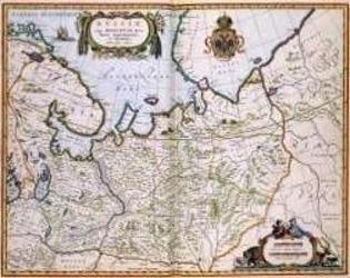
North Eastern Russia of the 1600's
A historical map of northeastern Russia as understood in the 1600s, depicting towns, cities, and borders recorded by Joan and Cornelis Blaeu. A detailed cartouche features the Russian coat of arms. The map measures 56 by 44.3 inches and is suited to historical gaming, role-playing, or display.
- Spelare
- 0
Om spelet
- Design
- Illustrationer
- Utgivare

Expansion till
Se dem i Ludoya
Gratis, på webben, Android och iOS
Spela North Eastern Russia of the 1600's med Ludoya
- Ha det i din samlingHåll koll på ditt exemplar och dess expansioner, låna ut det till vänner, eller lägg det på din önskelista och få veta när priset sjunker.Lägg till i din samling
- Registrera varje spelomgångPoäng, vinnare, timers och foton, sedan din statistik: vinstprocent, favoritantal spelare, bästa poäng.Registrera en spelomgång
- Räkna poäng utan papperAnvänd communityns poängblad och spelhjälpmedel, och låt Ludoya räkna ihop poängen.Hitta poängblad
- Hitta folk att spela det medKlubbar, spelkvällar och evenemang nära dig där det här spelet kommer på bordet.Se evenemang
Speldata (spelare, speltid, ålder, medverkande) från BoardGameGeek.