
2005 · Kiegészítő (dobókockák, térképek, képernyők, kártyák)
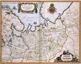
North Eastern Russia of the 1600's
A historical map of northeastern Russia as understood in the 1600s, depicting towns, cities, and borders recorded by Joan and Cornelis Blaeu. A detailed cartouche features the Russian coat of arms. The map measures 56 by 44.3 inches and is suited to historical gaming, role-playing, or display.
- Játékosok
- 0
A játékról
- Tervezés
- Grafika

Kiegészítő ehhez:
Nézd meg őket a Ludoyában
Ingyenes, weben, Androidon és iOS-en
Játszd a(z) North Eastern Russia of the 1600's játékot a Ludoyával
- Tartsd a gyűjteményedbenKövesd a példányodat és a kiegészítőit, add kölcsön a barátaidnak, vagy tedd fel a kívánságlistádra, és szólunk, ha csökken az ára.Add hozzá a gyűjteményedhez
- Rögzíts minden játszmátPontok, győztesek, időzítők és fotók, aztán a statisztikáid: győzelmi arány, kedvenc játékosszám, legjobb pontszám.Játszma rögzítése
- Pontozz papír nélkülHasználd a közösség pontozólapjait és játéksegédeit, és a Ludoya összeadja a pontokat.Pontozólapok keresése
- Találj játszótársakat hozzáKlubok, játékestek és események a közeledben, ahol ez a játék asztalra kerül.Események megtekintése
Játékadatok (játékosok, játékidő, kor, alkotók) forrása: BoardGameGeek.