
2004 · アクセサリー(ダイス、マップ、スクリーン、カード)
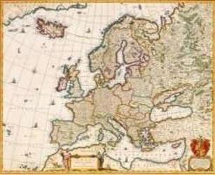
Europe of the 1600's
A historical map depicting Europe as understood by Niccolaas Visscher I in the 1600s. It shows countries, towns, cities, and borders of the period, and reflects the atlas index maps used at the time. The print measures 55.3 inches wide by 44.5 inches high.
- プレイ人数
- 0
ゲームについて
- デザイン
- アート

拡張の対象
Ludoyaで見る
ゲーム情報(人数、プレイ時間、対象年齢、クレジット)の出典:BoardGameGeek。