
2005 · アクセサリー(ダイス、マップ、スクリーン、カード)
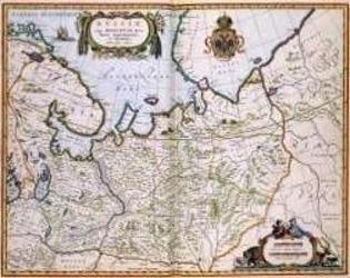
North Eastern Russia of the 1600's
A historical map of northeastern Russia as understood in the 1600s, depicting towns, cities, and borders recorded by Joan and Cornelis Blaeu. A detailed cartouche features the Russian coat of arms. The map measures 56 by 44.3 inches and is suited to historical gaming, role-playing, or display.
- プレイ人数
- 0
ゲームについて
- デザイン
- アート

拡張の対象
Ludoyaで見る
無料・Web、Android、iOS対応
LudoyaでNorth Eastern Russia of the 1600'sを遊ぼう
ゲーム情報(人数、プレイ時間、対象年齢、クレジット)の出典:BoardGameGeek。