
2005 · Tilbehør (terninger, kort, skærme, spillekort)
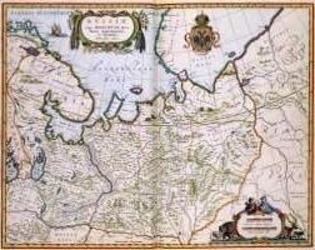
North Eastern Russia of the 1600's
A historical map of northeastern Russia as understood in the 1600s, depicting towns, cities, and borders recorded by Joan and Cornelis Blaeu. A detailed cartouche features the Russian coat of arms. The map measures 56 by 44.3 inches and is suited to historical gaming, role-playing, or display.
- Spillere
- 0
Om spillet
- Design
- Illustration
- Udgiver

Udvidelse til
Se dem i Ludoya
Gratis, på web, Android og iOS
Spil North Eastern Russia of the 1600's med Ludoya
- Hav det i din samlingHold styr på dit eksemplar og dets udvidelser, lån det ud til venner, eller sæt det på din ønskeliste, og få besked, når prisen falder.Føj det til din samling
- Registrér hvert partiPoint, vindere, timere og fotos, og så din statistik: vinderprocent, foretrukket spillerantal, bedste score.Registrér et parti
- Hold score uden papirBrug fællesskabets scoringsark og spilhjælpere, og lad Ludoya lægge pointene sammen.Find scoringsark
- Find nogen at spille det medKlubber, spilaftener og arrangementer nær dig, hvor dette spil kommer på bordet.Se arrangementer
Spilfakta (spillere, spilletid, alder, medvirkende) fra BoardGameGeek.