
2000 · Lisävaruste (nopat, kartat, näkösuojat, kortit)
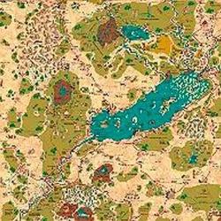
Country of Arduin Map
A full 2 x 3 ft, four-color poster map of Arduin, reproduced from David Hargrave’s original hand-drawn maps on parchment-style paper. It shows roads, cities, towns, villages, forests, named mountains, swamps, islands, seas, lakes, and other major geography, with a legend and scale included. The map is rolled and shipped in a tube.
Ominaisuus-/statspohjainen (STR, CON, PER, jne.)Tasoihin perustuva (ansaitse XP:tä ja nouse tasoille)Luokkapohjainen (pilotti, velho, tiedemies jne.)
Tietoa pelistä
- Suunnittelu
- Kuvitus
- Julkaisija

Laajennus peliin
Katso ne Ludoyassa


Ilmainen, verkossa, Androidilla ja iOS:llä
Pelaa peliä Country of Arduin Map Ludoyalla
- Pidä se kokoelmassasiPidä kirjaa kappaleestasi ja sen laajennuksista, lainaa sitä ystäville tai lisää se toivelistallesi ja saat tiedon, kun hinta laskee.Lisää se kokoelmaasi
- Kirjaa jokainen pelisessioPisteet, voittajat, ajastimet ja kuvat, sitten tilastosi: voittoprosentti, suosikkipelaajamäärä, paras tulos.Kirjaa pelisessio
- Pisteet ilman paperiaKäytä yhteisön pistelomakkeita ja peliapureita ja anna Ludoyan laskea pisteet.Etsi pistelomakkeita
- Löydä pelikavereitaKerhot, peli-illat ja tapahtumat lähelläsi, joissa tätä peliä pelataan.Katso tapahtumat
Pelin tiedot (pelaajat, peliaika, ikä, tekijät) lähteestä BoardGameGeek.