
2000 · アクセサリー(ダイス、マップ、スクリーン、カード)
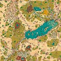
Country of Arduin Map
A full 2 x 3 ft, four-color poster map of Arduin, reproduced from David Hargrave’s original hand-drawn maps on parchment-style paper. It shows roads, cities, towns, villages, forests, named mountains, swamps, islands, seas, lakes, and other major geography, with a legend and scale included. The map is rolled and shipped in a tube.
属性/ステータス制(STR、CON、PERなど)レベル制(XPを獲得してレベルアップ)クラス制(パイロット、ウィザード、サイエンティストなど)


ゲーム情報(人数、プレイ時間、対象年齢、クレジット)の出典:BoardGameGeek。