
2005 · Accessoire (dobbelstenen, kaarten, schermen, speelkaarten)
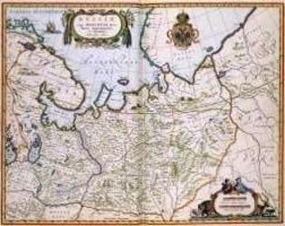
North Eastern Russia of the 1600's
A historical map of northeastern Russia as understood in the 1600s, depicting towns, cities, and borders recorded by Joan and Cornelis Blaeu. A detailed cartouche features the Russian coat of arms. The map measures 56 by 44.3 inches and is suited to historical gaming, role-playing, or display.
- Spelers
- 0
Over het spel
- Ontwerp
- Illustraties
- Uitgever

Uitbreiding voor
Bekijk ze in Ludoya
Gratis, op het web, Android en iOS
Speel North Eastern Russia of the 1600's met Ludoya
- Houd het bij in je collectieHoud je exemplaar en de uitbreidingen bij, leen het uit aan vrienden of zet het op je verlanglijst en krijg bericht als de prijs daalt.Voeg het toe aan je collectie
- Leg elke speelsessie vastScores, winnaars, timers en foto's, en dan je statistieken: winpercentage, favoriete spelersaantal, beste score.Speelsessie vastleggen
- Scoor zonder papierGebruik de scoreformulieren en speelhelpers van de community en laat Ludoya de punten optellen.Scoreformulieren zoeken
- Vind mensen om het mee te spelenClubs, spelavonden en evenementen bij jou in de buurt waar dit spel op tafel komt.Bekijk evenementen
Speldata (spelers, speeltijd, leeftijd, makers) van BoardGameGeek.