
2005 · Accessoire (dobbelstenen, kaarten, schermen, speelkaarten)
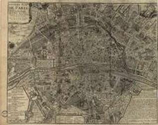
Paris of the 1700's
A historical map depicting Paris as understood in the 1700s, including named streets, districts, parks, local sites, and the Seine. A key identifies the city’s quarters and their estimated founding dates. It can be used as a reference for historical role-playing or displayed as a period map. Print size: 40.5 × 31.9 inches.
- Spelers
- 0
Over het spel
- Ontwerp
- Illustraties
- Uitgever

Uitbreiding voor
Bekijk ze in Ludoya
Gratis, op het web, Android en iOS
Speel Paris of the 1700's met Ludoya
- Houd het bij in je collectieHoud je exemplaar en de uitbreidingen bij, leen het uit aan vrienden of zet het op je verlanglijst en krijg bericht als de prijs daalt.Voeg het toe aan je collectie
- Leg elke speelsessie vastScores, winnaars, timers en foto's, en dan je statistieken: winpercentage, favoriete spelersaantal, beste score.Speelsessie vastleggen
- Scoor zonder papierGebruik de scoreformulieren en speelhelpers van de community en laat Ludoya de punten optellen.Scoreformulieren zoeken
- Vind mensen om het mee te spelenClubs, spelavonden en evenementen bij jou in de buurt waar dit spel op tafel komt.Bekijk evenementen
Speldata (spelers, speeltijd, leeftijd, makers) van BoardGameGeek.